Humanitarian geophysics plays a critical role in post-conflict recovery. Before land can be returned to communities, rebuilt infrastructure, or restored for agriculture, it must be assessed and cleared of threats and explosive remnants of war (ERW).
That responsibility starts below the surface.
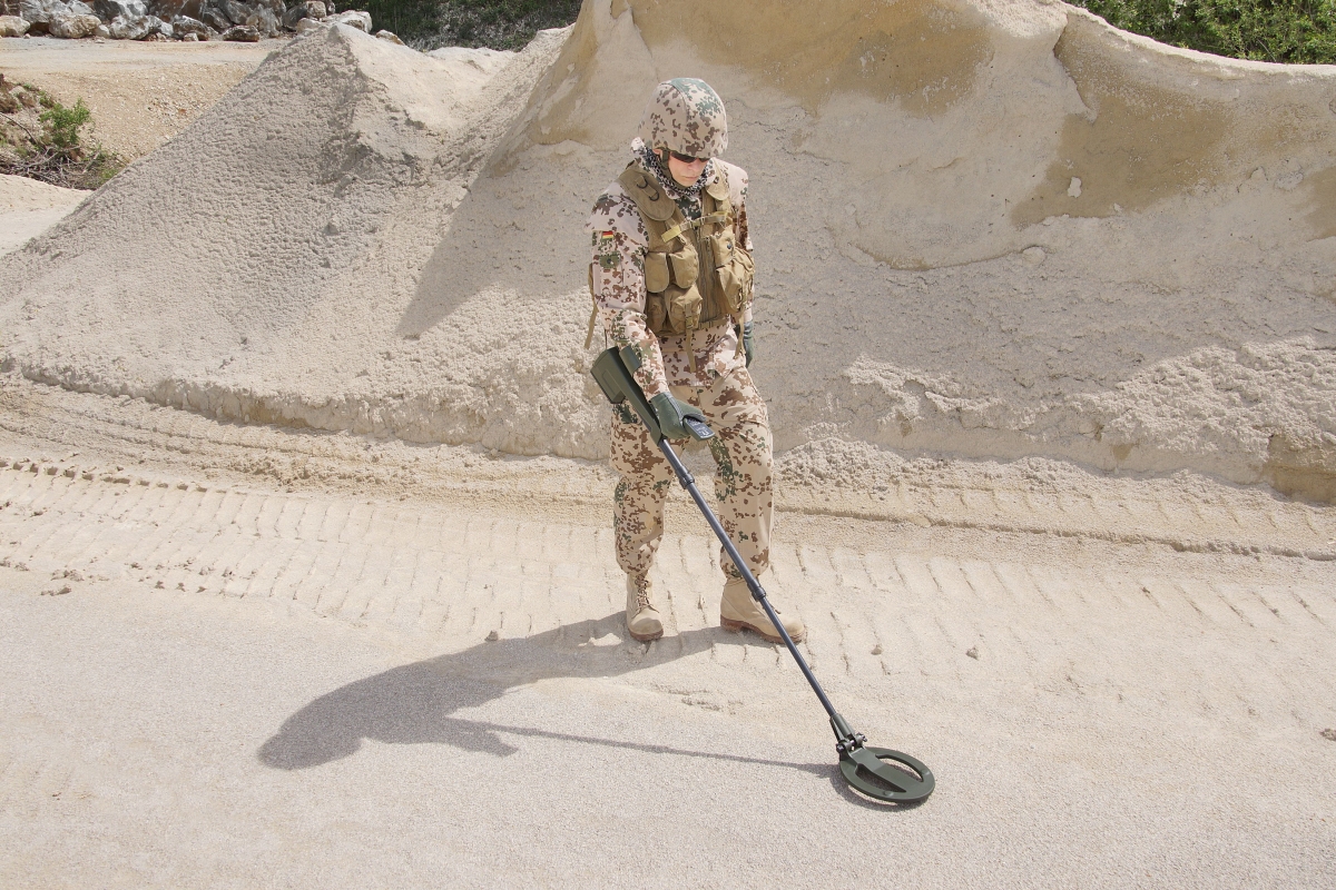
Magnetic surveying is one of the primary tools used to detect buried metallic components of anti-personnel mines, anti-tank mines, unexploded ordnance (UXO), and fragmentation of hazards. These surveys help you identify what cannot be seen and reduce risk before excavation begins.
But humanitarian environments are rarely simple.
Low-metal-content threats are increasingly common. Burial depths vary. Soils are non-homogenous. Many sites are magnetically noisy due to debris, infrastructure remnants, or past military activity. In these conditions, detection equipment must do more than respond to metal in the ground.
You need reliable discrimination.
You need precise localization.
You need data that supports safe and efficient clearance.
In humanitarian land remediation missions, detection alone is not the goal. The safe land release is.
Why It Matters: When Poor Resolution Slows Recovery
In land remediation programs, operational efficiency directly affects communities waiting for land to be declared safe. When anomaly resolution is limited, the consequences extend beyond the survey grid. Poor signal clarity often leads to:
-
Excessive excavation due to uncertainty
-
Increased operator risk
-
Increased operational costs
-
Greater exposure time for demining personnel
In humanitarian contexts, inefficiency delays land release. If land release is delayed, then agricultural use is postponed, and infrastructure projects stall, leaving communities unable to recover.
The technical challenge is clear: you must achieve high detection sensitivity for small ferrous components while minimizing false positives in complex, magnetically cluttered environments.
With reliable discrimination and precise localization, you can prioritize targets and deploy clearance resources to where they matter most.
How FOERSTER Helps: Strengthening Signal Clarity in the Field
We approach humanitarian geophysics with a focus on measurable signal quality and operational stability.
The FEREX 4.034 is a high-sensitivity flux-gate magnetometer system designed to strengthen action workflows. With nanotesla-level resolution and stable gradiometer configurations, it improves the detection of both large and small ferrous signatures typical of UXO and ERW components.
What makes the difference in the field is not just sensitivity, but gradient fidelity and signal-to-noise performance.
The FEREX 4.034 supports:
- Stable gradiometer measurements
- Enhanced gradient resolution
- High-density data acquisition
- Improved localization accuracy
In structured humanitarian workflows such as:
- Systematic grid-based scanning
- Area reduction surveys
- Technical survey and clearance support
Higher signal clarity enables stronger anomaly discrimination and prioritization.
In practical terms, that means clearer dipole characterization, reduced interpretation of ambiguity, and more confident target classification. Clearance teams can focus their efforts where the risk is highest, rather than expending time on uncertain anomalies. The FEREX system enhances both operational efficiency and safety margin.
Having a clearer anomaly definition scan reduces unnecessary excavation. Reduced excavation shortens exposure time. Shorter exposure improves safety.
Better magnetic data directly contributes to safer operations and faster land release.
Actionable Takeaways for Humanitarian Survey Teams
If you are planning or optimizing a humanitarian magnetic survey, consider these principles:
Prioritize signal-to-noise performance.
Low-metal mines require strong gradient fidelity and stable measurements. Sensitivity alone is not enough.
Validate equipment under real field conditions.
Heterogeneous soils and magnetic clutter can affect performance. Field benchmarking ensures reliability before large-scale deployment.
Integrate high-resolution surveys into structured workflows.
Grid-based scanning and area reduction strategies benefit from dense, stable datasets that support quantitative interpretation.
Focus on discrimination, not just detection.
Operational efficiency depends on minimizing false positives while maintaining safety margins.
Remember the bigger objective.
Every improvement in anomaly resolution contributes to faster, safer land release for communities.
The FEREX 4.034 strengthens that mission by transforming magnetic detection into higher-confidence, high-resolution survey data. By improving signal clarity and localization accuracy, it supports safer excavation decisions and more efficient clearance of workflows.
Because in post-conflict environments, better data does more than improve performance.
It accelerates recovery.
It reduces risk.
And it helps return land to the people who depend on it.
.png)
.png?width=1920&height=1080&name=Blog%20Post%20-%20Large%20Hero%20Image%20(11).png)